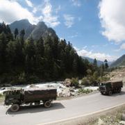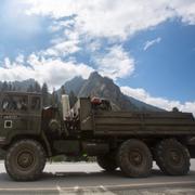
Indien och Kina rök ihop i omstridd gränsregion
För första gången på två år har indiska och kinesiska styrkor hamnat i konflikt vid den omstridda landgränsen i Himalaya, rapporterar CNN.
Soldater på båda sidor ska ha ådragit sig lindriga skador i sammandrabbningen. Det är oklart hur.
Enligt ett uttalande från det indiska försvarsdepartementet höll befälhavare från båda sidor ett möte kort efteråt för att diskutera incidenten.
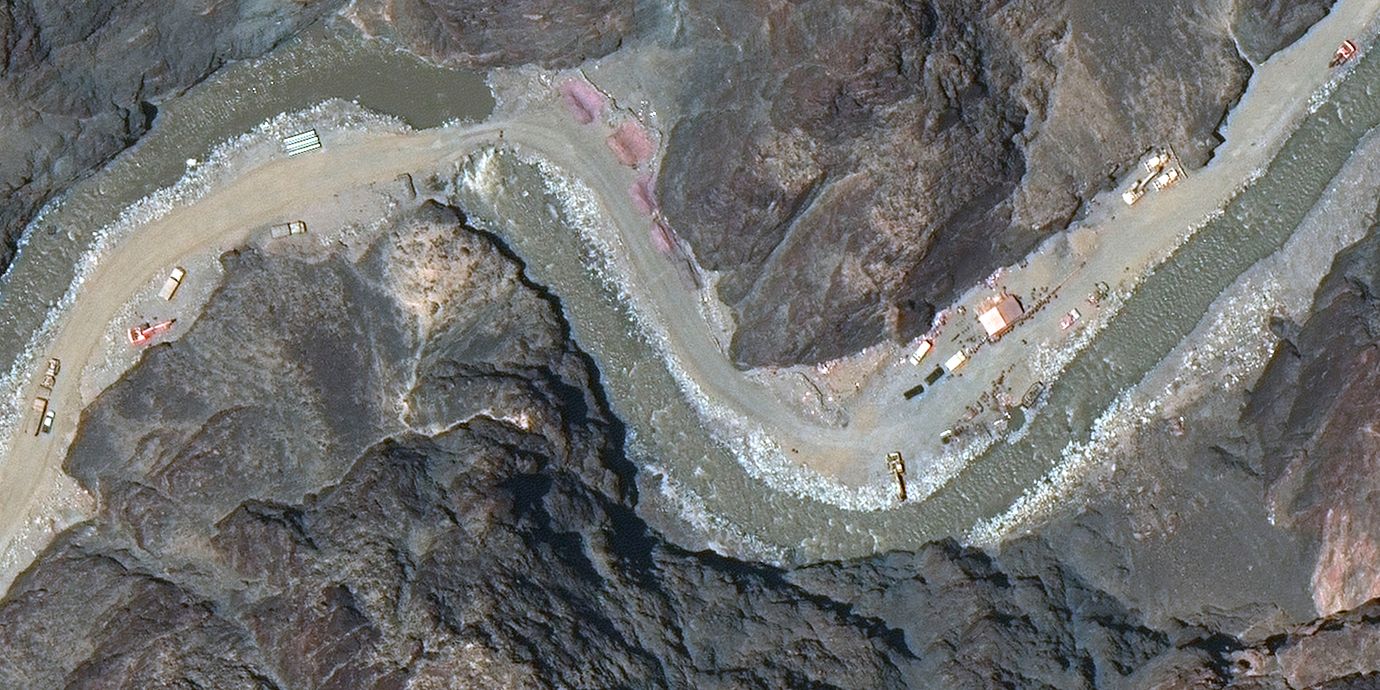
Det hela utspelade sig vid den så kallade ”faktiska kontrollinjen”, ett gränsområde i den nordostliga indiska delstaten Arunchal Pradesh som Kina gör anspråk på. Gränskonflikten har pågått sedan 1960-talet.
bakgrund
Den faktiska kontrollinjen
Wikipedia (en)
The Line of Actual Control (LAC), in the context of the Sino-Indian border dispute, is a notional demarcation line
that separates Indian-controlled territory from Chinese-controlled territory. The concept was introduced by Chinese premier Zhou Enlai in a 1959 letter to Jawaharlal Nehru as the "line up to which each side exercises actual control", but rejected by Nehru as being incoherent. Subsequently the term came to refer to the line formed after the 1962 Sino-Indian War.The LAC is different from the borders claimed by each country in the Sino-Indian border dispute. The Indian claims include the entire Aksai Chin region and the Chinese claims include Arunachal Pradesh. These claims are not included in the concept of "actual control".
The LAC is generally divided into three sectors:
the western sector between Ladakh on the Indian side and the Tibet and Xinjiang autonomous regions on the Chinese side. This sector was the location of the 2020 China–India skirmishes.
the middle sector between Uttarakhand and Himachal Pradesh on the Indian side and the Tibet autonomous region on the Chinese side.
the eastern sector between Arunachal Pradesh on the Indian side and the Tibet autonomous region on the Chinese side. This sector generally follows the McMahon Line.The term "line of actual control" originally referred only to the boundary in the western sector after the 1962 Sino-Indian War, but during the 1990s came to refer to the entire de facto border.
bakgrund
Kinesisk-indiska gränskonflikten
Wikipedia (en)
The Sino-Indian border dispute is an ongoing territorial dispute over the sovereignty of two relatively large, and several smaller, separated pieces of territory between China and India. The first of the territories, Aksai Chin, is administered by China as part of the Xinjiang Uygur Autonomous Region and Tibet Autonomous Region and claimed by India as part of the union territory of Ladakh; it is the most uninhabited high-altitude wasteland in the larger regions of Kashmir and Tibet and is crossed by the Xinjiang-Tibet Highway, but with some significant pasture lands at the margins. The other disputed territory is south of the McMahon Line, formerly known as the North-East Frontier Agency and now called Arunachal Pradesh. The McMahon Line was part of the 1914 Simla Convention signed between British India and Tibet, without China's agreement. China disowns the agreement, stating that Tibet was never independent when it signed the Simla Convention.
The 1962 Sino-Indian War was fought in both disputed areas. Chinese troops attacked Indian border posts in Ladakh in the west and crossed the McMahon line in the east. There was a brief border clash in 1967 in the region of Sikkim. In 1987 and in 2013, potential conflicts over the two differing Lines of Actual Control were successfully de-escalated. A conflict involving a Bhutanese-controlled area on the border between Bhutan and China was successfully de-escalated in 2017 following injuries to both Indian and Chinese troops. Multiple brawls broke out in 2020, escalating to dozens of deaths in June 2020.Agreements signed pending the ultimate resolution of the boundary question were concluded in 1993 and 1996. This included "confidence-building measures" and the Line of Actual Control. To address the boundary question formalised groups were created such as the Joint Working Group (JWG) on the boundary question. It would be assisted by the Diplomatic and Military Expert Group. In 2003 the Special Representatives (SRs) mechanism was constituted. In 2012 another dispute resolution mechanism, the Working Mechanism for Consultation and Coordination (WMCC) was framed.
Arunchal Pradesh, Indien

Omni är politiskt obundna och oberoende. Vi strävar efter att ge fler perspektiv på nyheterna. Har du frågor eller synpunkter kring vår rapportering? Kontakta redaktionen