Meteorolog: Räkna med kraftigare stormar
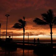
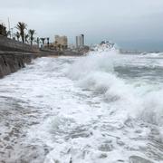
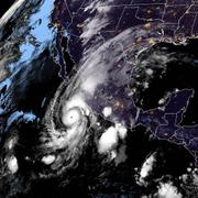
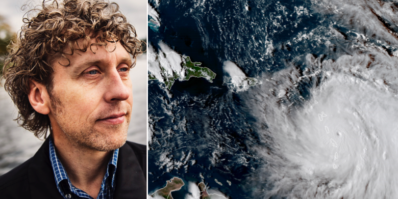
Världen får räkna med att orkaner, liknande de som just nu plågar Central- och Nordamerika, i framtiden kommer att bli kraftigare och orsaka större skador. Det säger SVT:s meteorolog Pererik Åberg till den egna kanalen.
– Forskningsresultatet säger att vi kanske inte får fler i framtiden men att de vi får är kraftigare än tidigare. Alltså att de är högre upp i skalan, mellan 3-5, i stället för 1-2.
Orkaner som Irma och den nu pågående Maria följer det scenario som FN:s klimatpanel beskrivit till följd av den globala uppvärmningen.
bakgrund
Orkanskalan Saffir–Simpson
Wikipedia (en)
The Saffir–Simpson hurricane wind scale (SSHWS), formerly the Saffir–Simpson hurricane scale (SSHS), classifies hurricanes – Western Hemisphere tropical cyclones that exceed the intensities of tropical depressions and tropical storms – into five categories distinguished by the intensities of their sustained winds. To be classified as a hurricane, a tropical cyclone must have maximum sustained winds of at least 74 mph (33 m/s; 64 kn; 119 km/h) (Category 1). The highest classification in the scale, Category 5, contains storms with sustained winds exceeding 156 mph (70 m/s; 136 kn; 251 km/h).
The classifications can provide some indication of the potential damage and flooding a hurricane will cause upon landfall.
Officially, the Saffir–Simpson hurricane wind scale is used only to describe hurricanes forming in the Atlantic Ocean and northern Pacific Ocean east of the International Date Line. Other areas use different scales to label these storms, which are called "cyclones" or "typhoons", depending on the area.
There is some criticism of the SSHS for not taking rain, storm surge, and other important factors into consideration, but SSHS defenders say that part of the goal of SSHS is to be straightforward and simple to understand.
Omni är politiskt obundna och oberoende. Vi strävar efter att ge fler perspektiv på nyheterna. Har du frågor eller synpunkter kring vår rapportering? Kontakta redaktionen