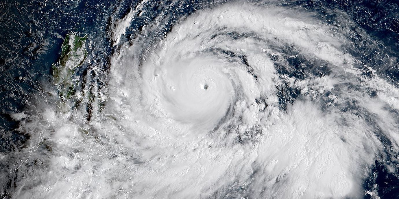
Supertyfon närmar sig Filippinerna och Hongkong
Samtidigt som orkanen Florence närmar sig USA är supertyfonen Mangkhut på väg att dra in över Filippinerna, Taiwan och Hongkong. Enligt myndigheterna befinner sig tio miljoner människor i Filippinerna i tyfonens väg, och ytterligare flera miljoner längs den kinesiska kusten.
Tyfonen motsvarar en kategori fem-orkan på Atlanten och den tilltar fortfarande i styrka, rapporterar Hongkongbaserade South China Morning Post.
– Vi oroar oss för de tio miljoner människor i Filippinerna som bor i vägen för den här destruktiva stormen, inklusive de som redan har fått flytta flera gånger på grund av monsunregnen i juli och augusti, säger Richard Gordon vid Röda Korset i Filippinerna till The Guardian.
bakgrund
Så mäts tropiska oväder
Wikipedia (en)
Tropical cyclones are officially ranked on one of five tropical cyclone intensity scales, according to their maximum sustained winds and which tropical cyclone basin(s) they are located in. Only a few scales of classifications are used officially by the meteorological agencies monitoring the tropical cyclones, but some alternative scales also exist, such as accumulated cyclone energy, the Power Dissipation Index, the Integrated Kinetic Energy Index, and the Hurricane Severity Index.
Tropical cyclones that develop in the Northern Hemisphere are officially classified by the warning centres on one of three intensity scales. Tropical cyclones or subtropical cyclones that exist within the North Atlantic Ocean or the North-eastern Pacific Ocean are classified as either tropical depressions or tropical storms. Should a system intensify further and become a hurricane, then it will be classified on the Saffir–Simpson hurricane wind scale, which is based on the estimated maximum sustained winds over a 1-minute period. In the Western Pacific, the Typhoon Committee uses four separate classifications for tropical cyclones that exist within the basin, which are based on the estimated maximum sustained winds over a 10-minute period.
The India Meteorological Department's scale uses 7 different classifications for systems within the North Indian Ocean, and are based on the systems estimated 3-minute maximum sustained winds. Tropical cyclones that develop in the Southern Hemisphere are only officially classified by the warning centres on one of two scales, which are both based on 10-minute sustained wind speeds: The Australian tropical cyclone intensity scale is used to classify systems within the Australian or South Pacific tropical cyclone basin. The scale used to classify systems in the South-West Indian Ocean is defined by Meteo France for use in various French territories, including New Caledonia and French Polynesia.
The definition of sustained winds recommended by the World Meteorological Organization (WMO) and used by most weather agencies is that of a 10-minute average at a height of 10 m (33 ft). However, the Saffir–Simpson Hurricane Scale is based on wind speed measurements averaged over a 1-minute period, at 10 m (33 ft) above the surface. The scale used by RSMC New Delhi applies a 3-minute averaging period, and the Australian scale is based on both 3-second wind gusts and maximum sustained winds averaged over a 10-minute interval. These make direct comparisons between basins difficult.
Within all basins tropical cyclones are named when the sustained winds hit 35 kn (40 mph; 65 km/h).
Omni är politiskt obundna och oberoende. Vi strävar efter att ge fler perspektiv på nyheterna. Har du frågor eller synpunkter kring vår rapportering? Kontakta redaktionen