Hem
En världskarta med Peters projektion (Daniel R. Strebe/Wikimedia commons)

Ny karta ger skolbarn en annan syn på världen

Eleverna i Bostons kommunala skolor ska få en annan syn på världen. Skoldistriktet börjar nu köpa in kartor med Peters projektion som ett komplement till kartorna med den klassiska Mercators projektion, som varit norm i över 400 år, skriver Boston Globe.

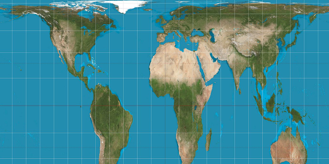
Mercators projektion har kritiserats för att den förvränger storleksförhållandena mellan kontinenterna till de gamla imperiernas fördel. Vilket till exempel ger intrycket att Europa är lika stort som Latinamerika, trots att det bara är hälften så stort. Kartor med Peters projektion ger länder korrekt ytfördelning men kan till exempel inte användas för att navigera efter.

– Det här är starten på ett tre år långt projekt för att avkolonialisera läroplanen i våra kommunala skolor, säger skoltjäsntemannen Colin Rose till The Guardian.

bakgrund
 
Peters projektion
Wikipedia (en)
The Gall–Peters projection, named after James Gall and Arno Peters, is one specialization of a configurable equal-area map projection known as the equal-area cylindric or cylindrical equal-area projection. It achieved considerable notoriety in the late 20th century as the centerpiece of a controversy about the political implications of map design. Maps based on the projection are promoted by UNESCO, and they are also widely used by British schools.
bakgrund
 
Mercators projektion
Wikipedia (en)
The Mercator projection is a cylindrical map projection presented by the Flemish geographer and cartographer Gerardus Mercator in 1569. It became the standard map projection for nautical purposes because of its ability to represent lines of constant course, known as rhumb lines or loxodromes, as straight segments that conserve the angles with the meridians. Although the linear scale is equal in all directions around any point, thus preserving the angles and the shapes of small objects (which makes the projection conformal), the Mercator projection distorts the size of objects as the latitude increases from the Equator to the poles, where the scale becomes infinite. So, for example, landmasses such as Greenland and Antarctica appear much larger than they actually are relative to land masses near the equator, such as Central Africa.
Omni är politiskt obundna och oberoende. Vi strävar efter att ge fler perspektiv på nyheterna. Har du frågor eller synpunkter kring vår rapportering? Kontakta redaktionen